Bathymetric and Side Scan Survey of Three San Diego Marinas
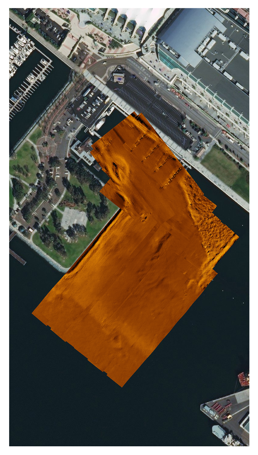
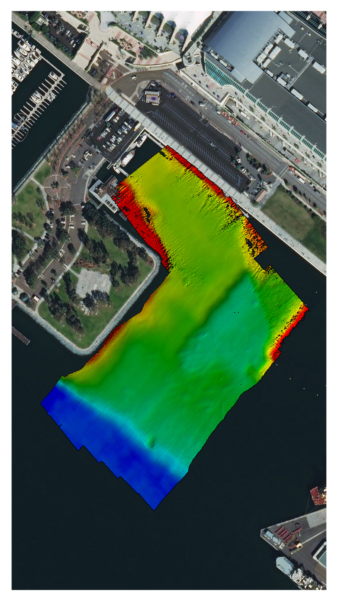
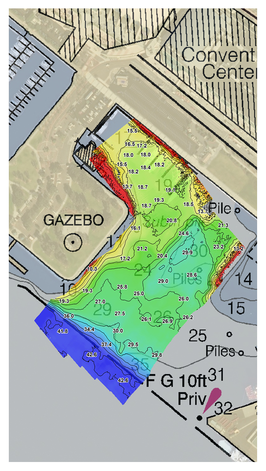
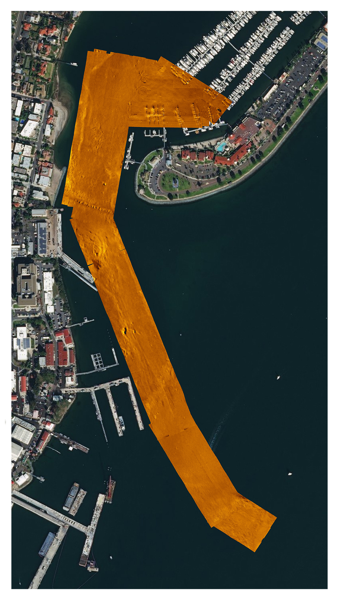
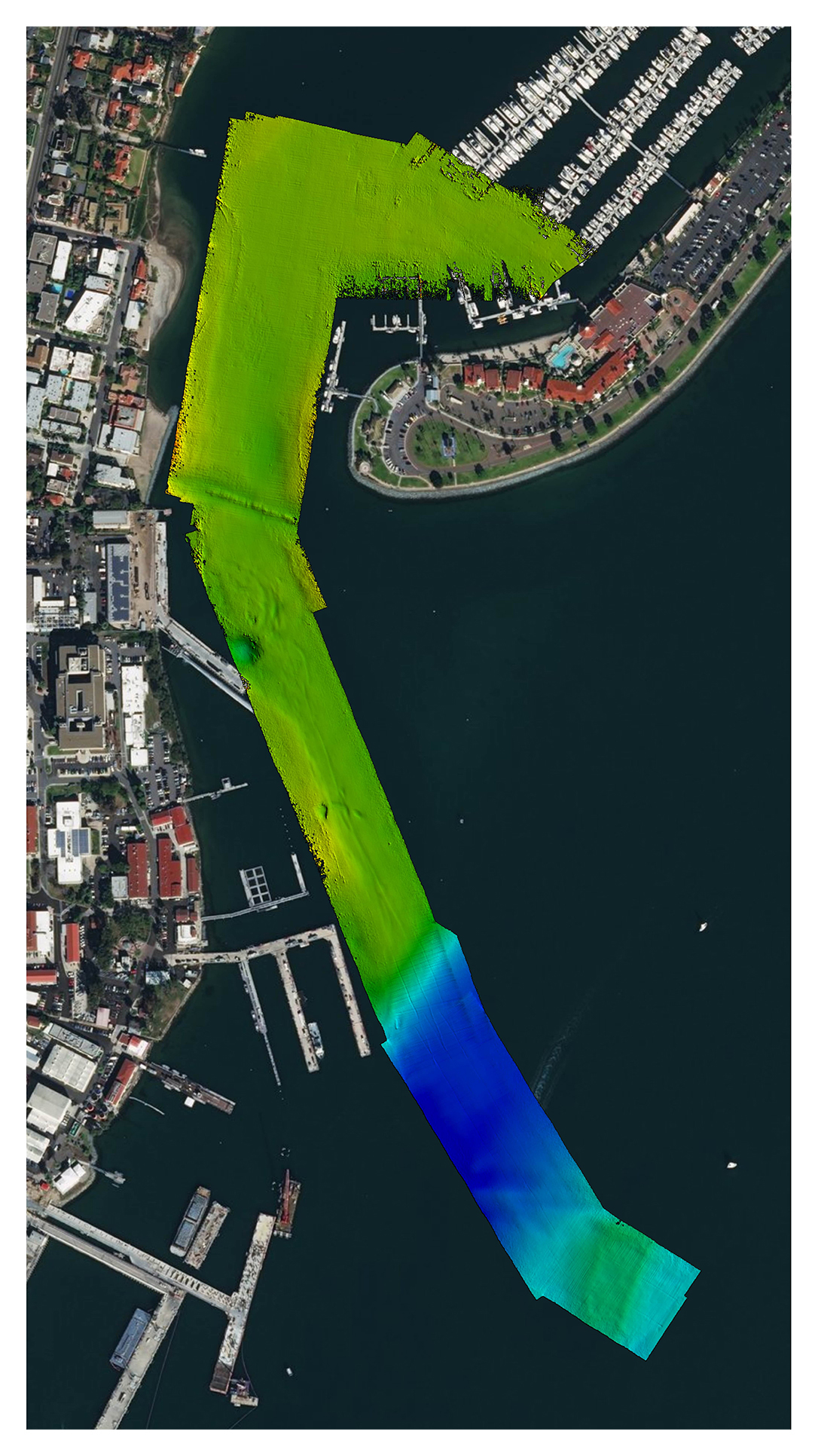
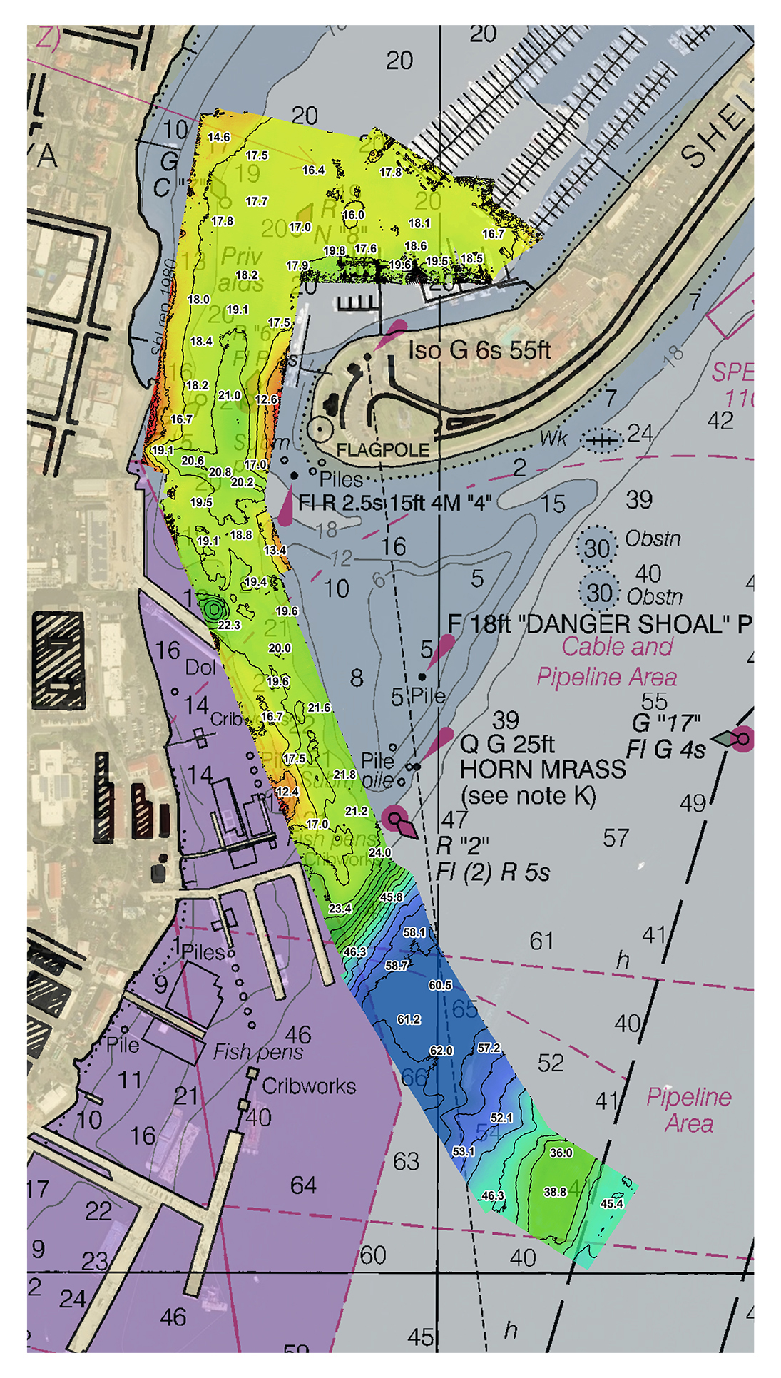
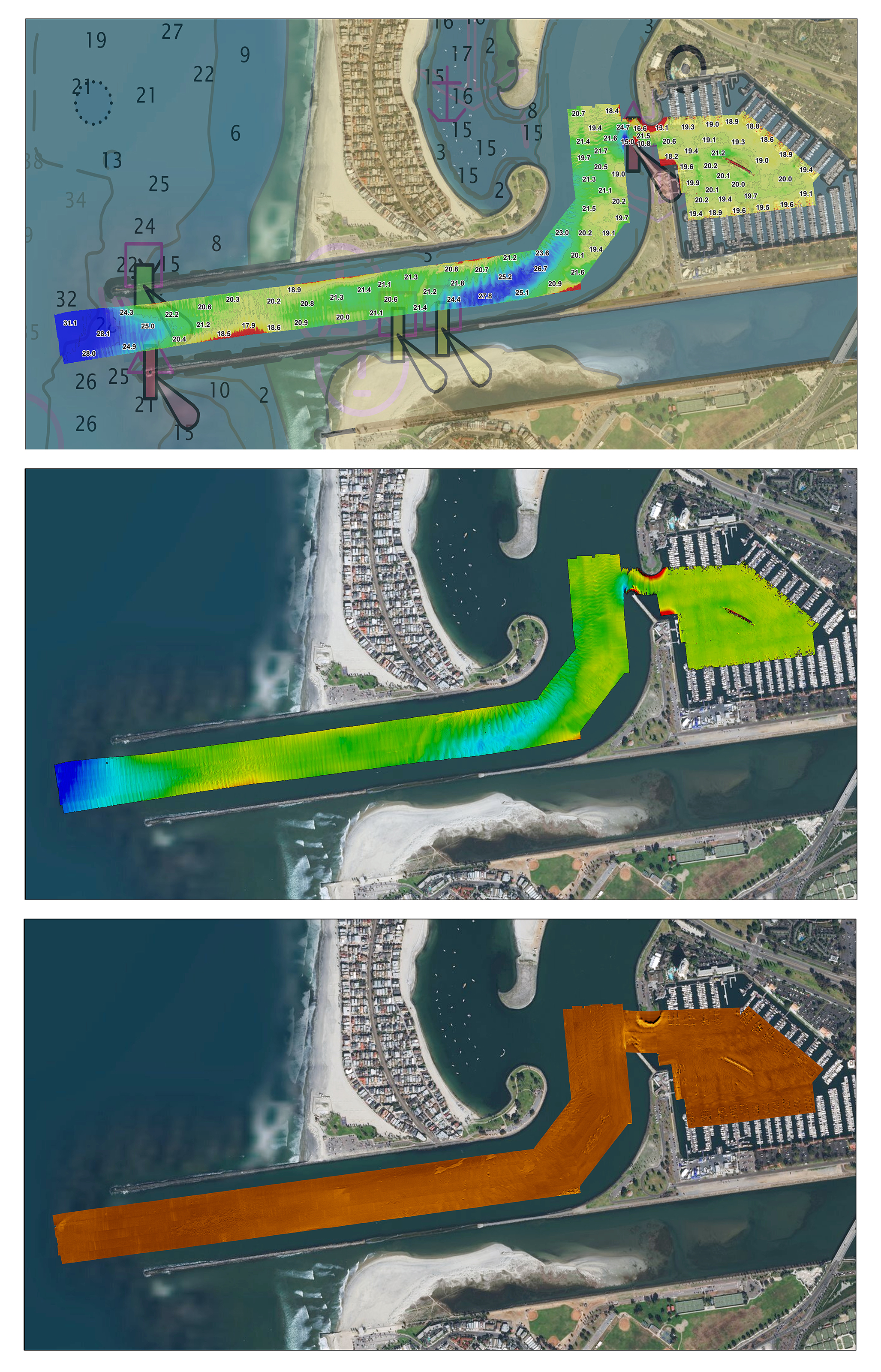
Surveys of three marinas and their approaches from the main channel were conducted using an Iver3 AUV. Each area was surveyed at night to deconflict with both pleasure and commercial vessel traffic. The surveys provided the client with imagery and depth values on three possible locations for passage and berthing of a deep draft vessel. The side scan and bathymetric sonar were collected by the AUV at the same time during each mission, providing co-registered data and efficiency.
